Historic Cattlemen of Gila County, Arizona
Many early pioneers that entered the Tonto Basin discovered prime livestock grazing areas and cattle ranching quickly became a major economic industry in the region following the Civil War as drought conditions in West Texas and slowing mining operations in California funneled families into Arizona Territory. The Cline family was one of the first to immigrate to Arizona beginning in the 1870s, eventually establishing a homestead and ranching operation at the confluence of the Salt River and Tonto Creek. Other families settled in the area prior to the beginning of the 20th century but were displaced by 1906 with the construction of Roosevelt Dam.
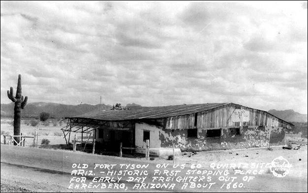
Quartzsite - a.k.a. Tyson’s Wells
The region of southern Arizona near modern day Quartzsite became attractive to ranchers in the second half of the nineteenth century, with cattle ranching becoming prominent in the Palo Verde area as well as the area around Blythe, California. Farming, wood-collecting, and mining quickly followed. By the 1920s, the Bureau of Reclamation had become involved in water control projects along the lower Colorado River. Its efforts included levee and channel construction and dredging (USDOI 1981). With the discovery of minerals in the 1850s, Arizona began to draw a significant number of settlers, including prospectors, miners, military personnel, farmers, ranchers and salespeople (Stein 1994; Edwards 2015).
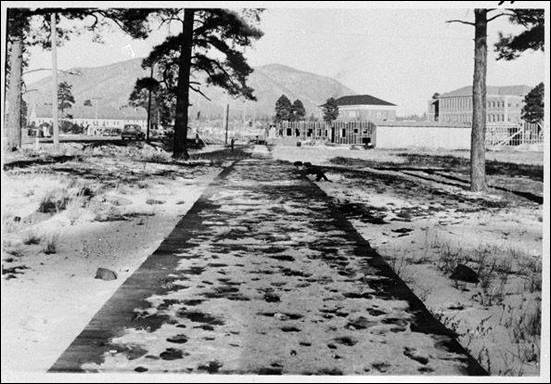
Gables Restaurant: A Route 66 Diner in Flagstaff, Arizona
In 2015, Cornerstone Environmental conducted archival research and provided historic preservation services to Shephard-Wesnitzer, Inc. for 700 and 702 S. Milton Rd., Flagstaff, Arizona, which are currently occupied by SuperPawn and Lu Mandarin Buffet, respectively. This work was performed per specifications in the City of Flagstaff Zoning Code prior to demolition of the two buildings to construct a CVS pharmacy at the site. The SuperPawn building was constructed in 1983 (Coconino County Assessor's Office) by the owners of Gables Restaurant as a disco/sports bar (R. Sean Evans, pers. comm. to Josh Edwards, February 23, 2015). The building was not over 50 years old and was not researched further since it is not historic. The building at 702 S. Milton has a long history, starting as the Golden Drumstick restaurant at the Park Plaza Motel, which is summarized below.
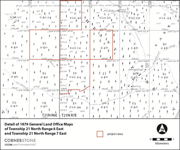
Obsevatory Mesa
In 2013, Cornerstone archaeologists surveyed of 2,260 acres of State land on Observatory Mesa, that is partially within and immediately northwest of the city limits of Flagstaff (Figure 1). The City of Flagstaff purchased the land using funding from the Arizona Preservation Initiative, with the intent of preserving the project parcels in perpetuity. The Arizona Preservation Initiative seeks to provide Arizonans with pristine views, enhance land values, retain essential wildlife corridors, create environmentally sensitive recreational opportunities, and preserve open space without air or light pollution.
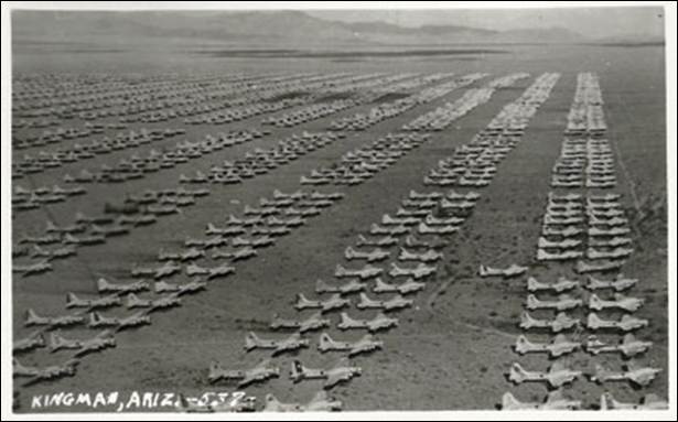
Kingman Army Air Field
In 2015, Cornerstone archaeologists surveyed a portion of the Kingman Army Air Field (KAAF: Figures 1 and 2) prior to construction of two photovoltaic renewable energy projects. Given that the area was known to be within the KAAF, and near to the headquarters (on the east side of Route 66), the surveyors were not surprised to find that the ground surface was littered with bullets. Local residents are familiar with these findings, as there are hundreds of thousands of bullet slugs commonly found for many square miles around the project area.
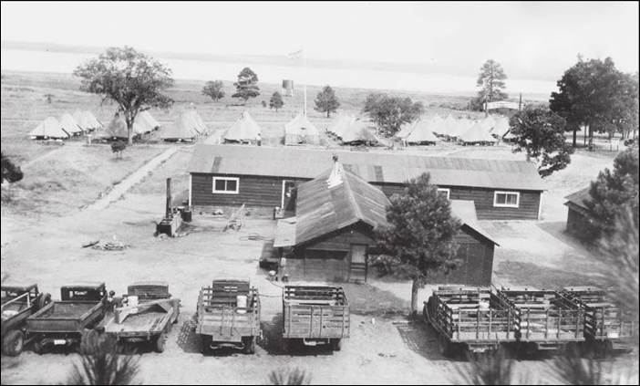
Double Springs Camp
Following the abandonment of the Mormon Lake area by Little Colorado River settlers by the late 1880s, the lands saw sporadic logging and ranching activities until the 1930s, when the Great Depression spurred the creation of federal programs aimed at creating recreational and forest management infrastructure across America’s public lands. In 2016, Cornerstone recorded the remains of Double Springs Camp (F-6-A), a Civilian Conservation Corps (CCC) camp overlooking the western edge of the lake. The CCC operated between 1933 and 1942, established by President Franklin D. Roosevelt to generate jobs for struggling Americans during the Great Depression (Otis et al. 1986).
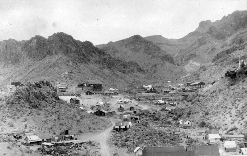
Goldroad and the Oatman Mining District
One of Arizona's most fascinating ghost towns, Goldroad is located along the zig-zags of Historic Route 66 in the mountains between Sitgreaves Pass and Oatman. This route was initially a well-traveled trail frequented by Native Americans for thousands of years. The locale has been witness to numerous notable individuals including Francisco Garcés, Antoine Leroux, Lorenzo Sitgreaves, Joseph Christmas Ives, Edward "Ned" Beale, and Mohave Chief Iretaba.
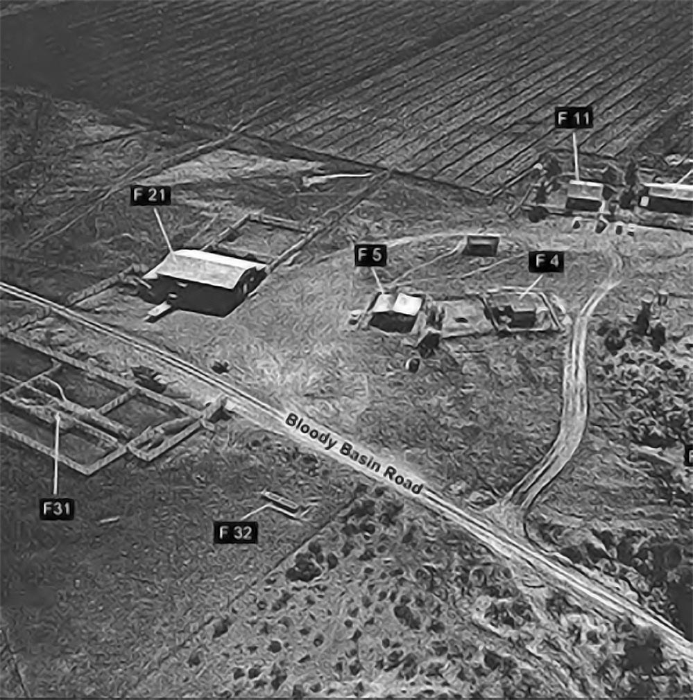
History of Horseshoe Ranch
In 2015 Cornerstone Environmental Consulting, LLC (Cornerstone) provided archaeological monitoring services to the Arizona Game & Fish Department (AGFD) while they were replacing and updating the ranch’s water system (Edwards et al. 2015). Horseshoe Ranch is a beautiful ranch headquarters complex located south of Cordes Junction and east of Interstate 17 in the Bloody Basin of central Arizona that is wholly surrounded by the 71,000-acre Agua Fria National Monument. The AGFD acquired the approximately 200-acre property in 2011, which sits on arable land at the confluence of Indian Creek with the Agua Fria River.
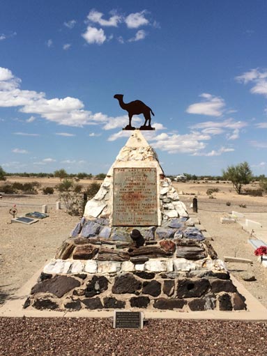
Hi Jolly - The Camel Driver
From late summer of 1857 to the winter of 1858, retired Navy Lieutenant Edward Fitzgerald Beale surveyed the 1,240-mile 35th Parallel Route from Ft. Smith, Arkansas, to the Colorado River (Beale 1858). In 1859, Beale’s road construction party was accompanied by the trial run of military camels as beasts of burden for the wagon road he constructed (National Park Service [NPS] 1977). The lead driver of this famous expedition was Ali al-Hajaya (born ca. 1828), an immigrant from the Levant and an Ottoman Turkish citizen who had accompanied the shipment of camels destined for military service across the Atlantic from the Middle East.
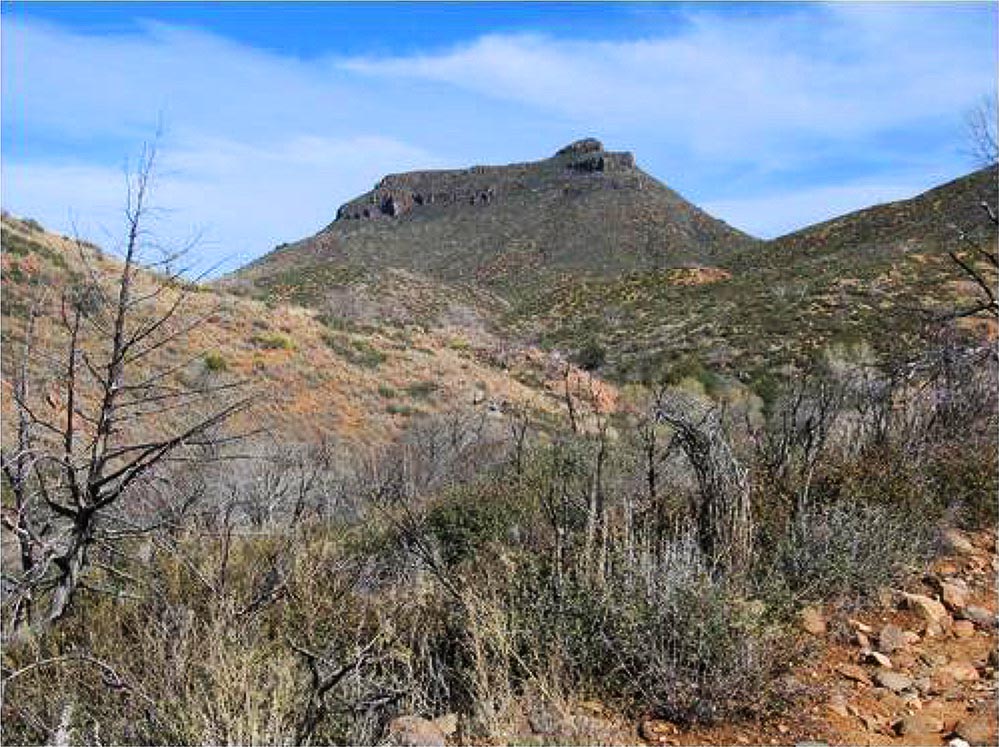
Battle of Turret Peak
The Bloody Basin is a physiographic region north of Perry Mesa, approximately 100 km north of Phoenix, Arizona, and was named for a series of bloody skirmishes between the U.S. Army and local Native Americans. The Tonto Basin Campaign was organized by General George Crook in 1871 in an attempt to put an end to the numerous small fights between Euroamerican settlers and Apache and Yavapai in central Arizona. The campaign’s purpose was to force the native population back on to reservations, with the Battle of Turret Peak being the turning point of the campaign.
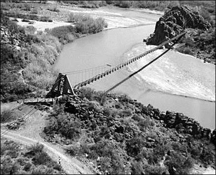
The Verde River Sheep Bridge
The Verde River Sheep Bridge (Figure 1), also known as the Red Point Sheep Bridge, is located along Bloody Basin Road, approximately 100 km north of Phoenix, Arizona, in Yavapai County. This suspension bridge was constructed to allow sheep to be driven between grazing ranges on either side of Arizona’s Verde River. Historical activities in the Bloody Basin were characterized by itinerant sheep herding, primarily staffed by Basque shepherds and laborers.
Are You Interested In Working With Us?
“Technically Sound, Technically Savvy.”
Client Testimonials
-
“Cornerstone Environmental did an excellent job in a timely manner to fulfill my request with a full environment and archaeology study at a fair price.”
I highly recommend Cornerstone Environmental for all your archaeology, historic preservation, and environmental projects.
- Robert Rodgers | Century Link